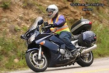
Today marks the completion of my first week of travel.I have already been on the road for 7 days – the time is flying by!During these 7 days I have logged more than 3,300 miles!I know some of you may think this is crazy, others of you will understand.To me, this is an opportunity of a life time and I want to make all I can out of it.As I travel the different regions and states, there is so much to see and admire.God has created this beautiful land so that we can enjoy it – that is one of my goals on this trip – enjoy as much of it as I can.
Today my journey brought me into the state of Utah.The first stop was ArchesNational Park.This park has many interesting rock formations that have been caused by the wind and/or rain eroding parts of the land while leaving other formations standing.Of course the park is famous for a number of “Arches” where a hole has been worn through part of the formation leaving the effect of either and arch or a bridge (it is called a bridge if it was caused by flowing water).I was able to take many interesting pictures of these various formations.My next stop was the NaturalBridgesNational Monument.There was a 9 mile driving tour with viewing points for many natural bridges.The formations here were not as outstanding as the ones in ArchesNational Park.From here I then continued my trek South and West across Utah (there is no good way to get across southern Utah)and I’m spending the night in Hanksville Utah (feels more like Hicksville to me!).The drive to Hanksville got a little boring.There are plenty of rock formations to see along the way but after a while, I got tied of seeing the same type of thing over and over again.
My next stops are planned to be BryceCanyonNational Park and then ZionNational Park in the southwest part of Utah.Hopefully the drive there will be OK.Everyone tells me these are “must see” parks.I hope to find out tomorrow.
The first thing I saw today as I started my ride is many hot air ballons descending into Gunnison (the town nearest to where my camp site was). There had to be more than 20 of them.
As I continued my ride, I saw 2 very different sides to the mountains in Colorado. First I took Hwy 50 and the Hwy 550 which took my through such areas as Ouray, Silverton, and Durango. This side of the mountains is what I believe most people think about when they think Colorado and Rocky Mountains. The mountains are of a more "Rocky" type. The roads though this area were amazing. Unfortunately for you (the readers), I wasn't able to get very many pictures because the roads were running right along the edge of the mountains are there just were not many safe turn-offs for me to use to capture pictures.
As I continued on from Durango to Cortez, Gateway, and eventually to Grand Junction, the mountains are very different. They are very red in color. This side of the mountain is much more dessert like. The area around Gateway was particularly beautiful. The two sides of the mountains I rode are not that far apart (as you can see on the Trip Log photo), but due to the elevation of the mountains the weather and conditions are very different.
Today will be my last day in Colorado. Tomorrow morning I will depart from my KOA camp ground tent site in Grand Junction and head to Utah and the Moab area.
What a way to spend the birthday of our country by riding through some of the most beautiful parts of the land.Today I got to see both the highs and the lows of this great land (literally).First I went through IndependencePass – also very appropriate for Independence Day!The pass reaches over 12,000 feet high.At the summit you can look down and see the roads as cars are climbing to the top.Taking 10 MPH corners with no outside railing at 12,000 feet takes some concentration and confidence in one’s ability.The lows came when I drove to the BlackCanyon of the GunnisonNationPark (west of GunnisonCO).Here you can look down into the canyon which is more than 2,000 feet deep in places and see the river as it continues to erode the canyon deeper and deeper.Through the canyon, the GunnisonRiver (which is the river my campsite for the evening was also on) drops about 95 feet every mile.This is what gives the river it great ability to eat away at the rock walls of the canyon.After viewing the canyon from the top, there is a road you can drive to get to the bottom of the canyon.This was amazing and challenging.The road dropped about 2,000 feet from top to bottom.It required 3 miles of road at 16% grade.Keeping the bike at the right speed (both going down and then going back up) are critical to keeping the shiny side up!
The downside of the day way a bad navigational decision I made.At one point I decided to take what appeared to be a very well maintained gravel road (packed and oiled so you could easily travel at 40 MPH) towards Crested Butte.Unfortunately, the well maintained road turned in to a regular gravel road part way through.Still it was not bad.However, it continued to get rougher and rougher.Do you turn back or do you hope it gets better again from the other direction?I choose to continue on.The bike and I survived, but a little dusty.I won’t be falling for that trick about a nice dirt road again any time soon!
Due to the fact that it is the 4th of July weekend, I figured lodging may be a little more difficult to come by.Both the KOA campgrounds in the area on my route were full but I found a U.S. Forest Service campground that was open and convenient just north of Gunnison.I stopped here early today to make sure I could at least have some place to sleep tonight.I am also discovering that it gets much colder at night here than I thought it would.I’m going to have to pick up some extra gear to keep me warm at night!
Note: The trip log capture is not complete. I must have hit the wrong button and wiped out the data for the first part of today's trip.
p.s.
Dick – the sausage was great and thanks for the advice on the route for today.Also, you were right about the road being gravel – I should have followed your recommendation and gone the other way to Gunnison!Live and learn!
First I need to say "Thank You" to a couple of families. Thank you to Bonnie and Bill for letting me stay at their house on Tuesday and Wednesday. I was nice to see you again and thanks for all you did for me while I was there. Tonight, I'm staying with Dick and Judy. Thanks to them for a great supper and letting me spend the night. Since I don't get to see either family very often, this worked out great. Thanks again to everyone for welcoming into your homes and taking such good care of me.
Today's ride took me north out of Denver towards Fort Collins through some great canyons. From there I headed up to Laramie Wyoming then west to the Snowy Range. They had a lot of snow up there this year and there was still plenty left! This area is not as high as Rocky Mountain National Park but is very beautiful and also has much less traffic to deal with. From there I headed back south and back to some more great canyons before returning to the Denver area. Today's trip was 474 miles. Tomorrow I will begin heading south towards Durango in southern Colorado.
Finally the mountains, I drove 1,000 miles through "not much" to get here and every mile is worth it! Today I spent time driving the mountain and carving the canyon roads west of Denver. The water is rushing in all the canyons as the snow is still melting and feeding the streams. Stops today included areas such as Estes Park and Rocky Mountain National Park. I purchased a national pass as I plan to visit several other parks along the way. Pictures can't describe the scenery but I have posted a few here from today's trip. I was able to see a few herds of elk along the road that coperated with the camera (some of them are so shy).
The trip log is also posted. Today's mileage was 320 mountain miles.
The sun came up early and so I was up also (part of this is also because I’m one time zone ahead of my body). As I was waking up, I heard the snorts of a white tail deer and then saw his white flag waving at me. It must not have been happy with the location of my camp site. I was on the road by 6:30. I started out west across more of Nebraska and the Sand Hills. I decided to take a little detour and see “Carhenge” which is a recreation of the “Stonehenge” in Europe but this one is created with cars. This little side trip was about 60 miles each way but worth the trip (once!). Along the way I also say people learning to climb power poles (see photos). After my detour I got back on track and rode through some more of the Sand Hills. Here I had my second encounter with wildlife, once again a bird was the fatality. I’m considering putting loud pipes on the bike so I don’t leave so much “road kill” behind me – they say “loud pipes saves lives” – they mean the birds right? Now it was time to continue westward toward Colorado. My route included about the last 200 miles to Denver on the slab “freeway”. This was a tough stretch as the wind began to pick up, the air temperature was at 95 for part of the ride. Fluid and stretch breaks were required about every hour. I arrived in Denver about mid afternoon. I plan to visit some relation this evening in the Denver area. Since I had a little spare time, I found a car wash to get one layer of “guts” of the bike – when you can’t see through the windshield you know it is time to get it washed.
My route for the day is the yellow line on the map photo: 458 miles
I can’t believe it is really happening!! I have been thinking about and planning this trip for many months and now it is time to make it happen. I left home at 8:00 am and had a great day of riding. Weather was great, blue sky the entire way. Temperatures were mostly in the upper 70 but reach 95 for a little while in Nebraska with very little wind to deal with. Not a whole lot of scenery today. Took pictures in South Dakota where I crossed the Missouri river. The best part of the ride was the 75 miles from Valentine to Mullen Nebraska on Highway 97. This takes you through the Nebraska Sand Hills. I found a campground in the Sand hills for $7.00 – very rustic. It was a challenge to ride into and out of the campground due to the gravel roads and pasture paths required to get to the campground (you had to open/close the pasture gate each time you went in/out). I found a new meaning for the word “tanker”. In Nebraska kids float down the river in large round metal cow tanks (life 10 – 15 ft across) rather than tubing down the river! I also had my first run in (literally) with wildlife. Some small bird didn’t’ realize how Goldwings can fly and there was a small collision (really just a “thud”). Fortunately the Goldwing was bigger than the bird and won!
The route I covered today is the yellow line on the map photo: 615 miles.